The Cann River catchment (1,167 km2) comprises the forested upland areas on the Victorian and New South Wales border, the cleared agricultural land on the floodplain around Noorinbee and Cann River township and Tamboon Inlet on the lower reaches of the river.
The river is formed at the confluence of two streams – the East and West branches of the Cann – at Weeragua, flowing into Tamboon Inlet, a coastal lagoon that is intermittently open to the ocean.
The public land in the catchment includes sections of Coopracambra and Croajingolong National Parks.
These remote areas include eucalypt forests, heathlands, rainforests, granite peaks and coastal headlands. These ecosystems support a diversity of flora and fauna, including 328 fauna and 1000 flora species recorded in the Croajingolong National Park.
The fertile Cann River floodplain mainly supports dairying and beef cattle grazing. The small township of Cann River, located at the junction of the Princes and Monaro Highways, is a rest stop for interstate travellers and a starting point for visitors to the Coopracambra and Croajingolong National Parks.
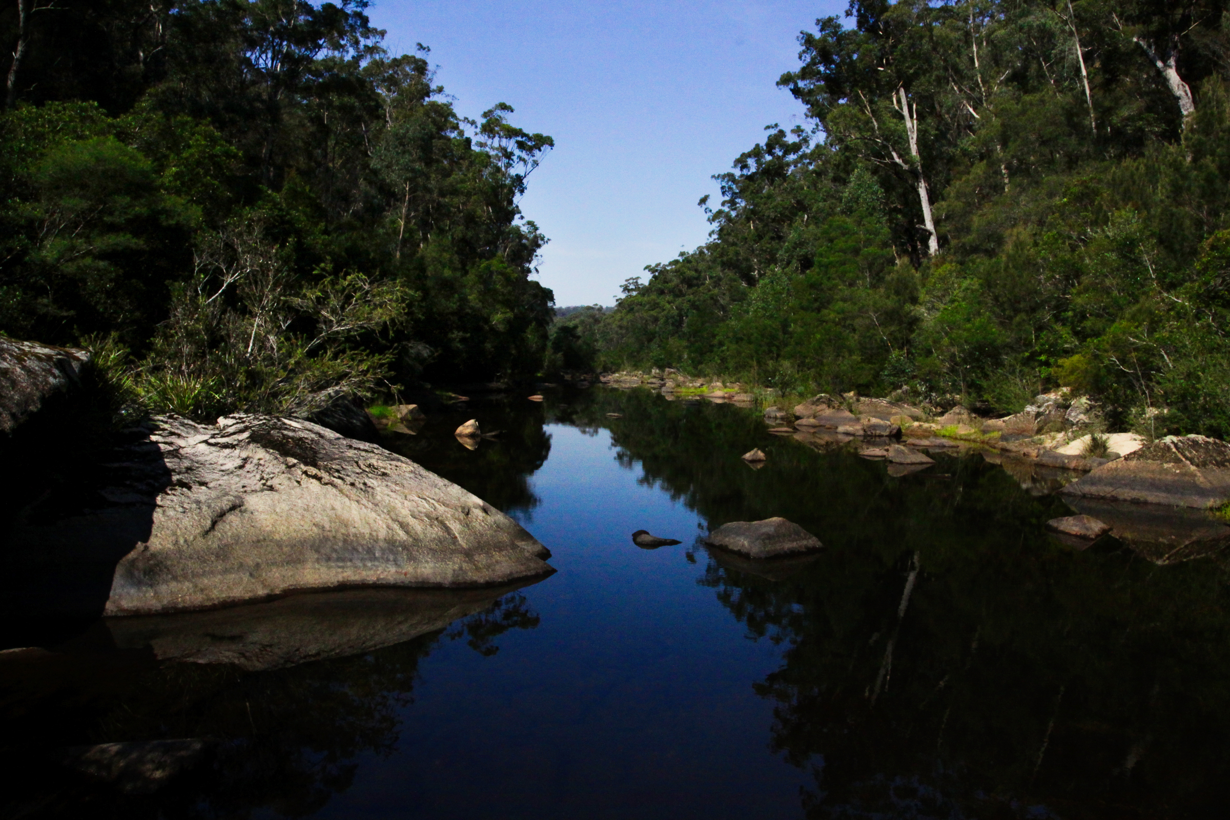
Tamboon Inlet is a haven for camping, fishing and bushwalking. It is recognised as a high-value wetland in the Directory of Important Wetlands. The outlet into Bass Strait is subject to periodic closure due to variations in river flows and climatic patterns.
Condition
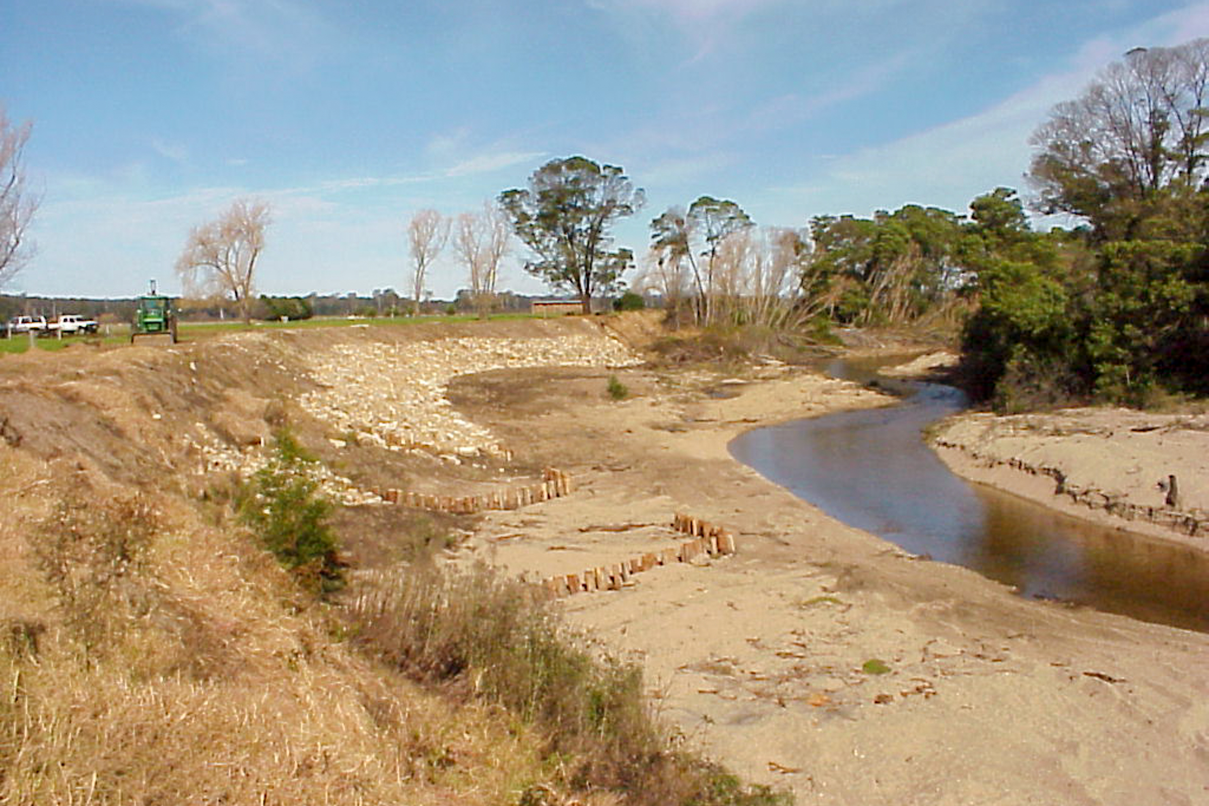
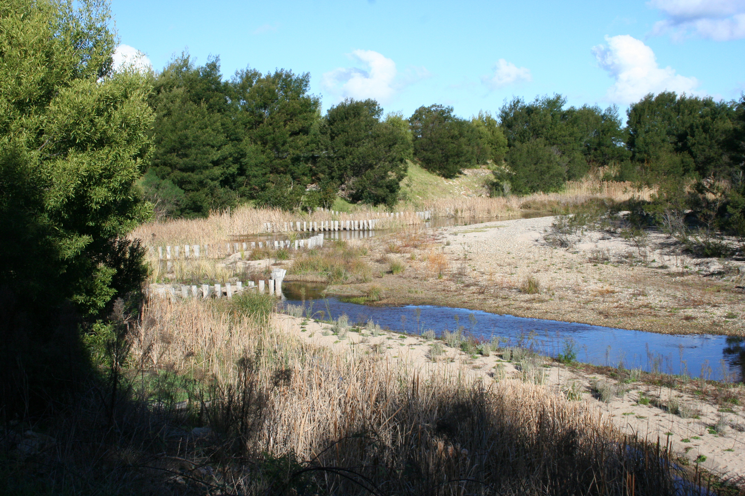
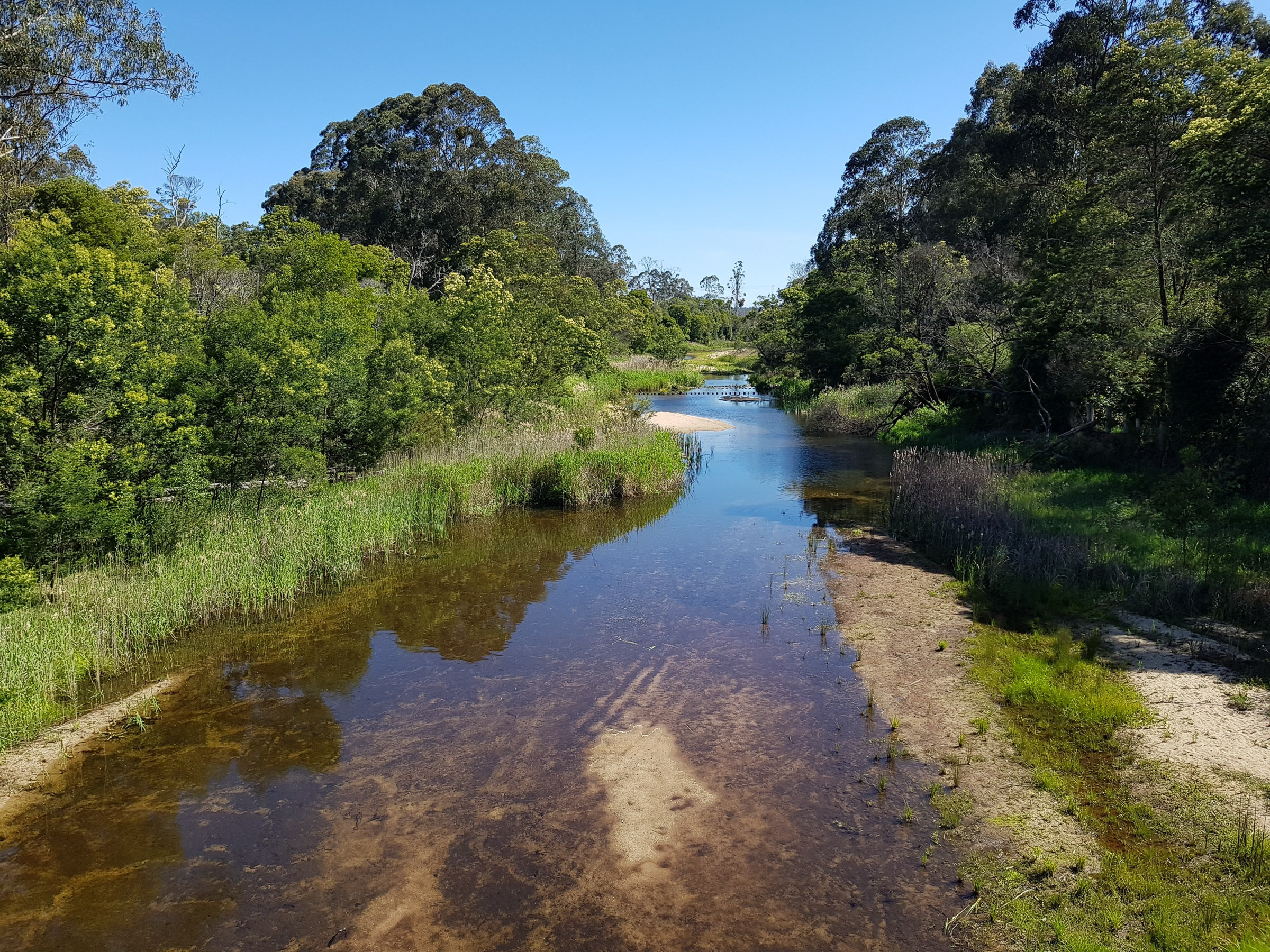
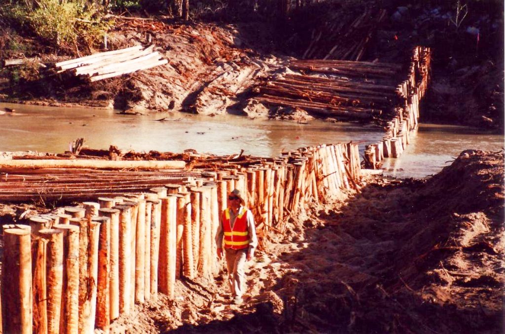
In recent years, a ‘natural healing approach’ has been taken to rehabilitate the river. Vegetation has been allowed to encroach into the river channel to capture and stabilise sediment (sand). Rock chutes and pile fields have been constructed to stabilise the river bed, retain sediment and provide a suitable environment for reeds and other aquatic plants to become established.
Native trees and shrubs have also been planted to stabilise the banks. Fences have been erected along the river to prevent stock eating and trampling new plants including those that have regenerated naturally.


History
The clearing of land for agriculture in the Cann Valley commenced in the 1870s. On the fertile floodplains, trees were ringbarked or felled, and vegetation was removed and burnt. Paddocks were ploughed, pasture sown and stock introduced.
River banks were cleared to provide stock access to water, for river crossings and by stock grazing.
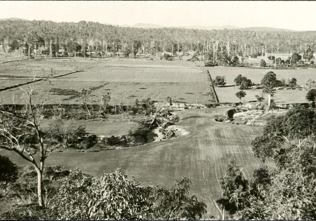
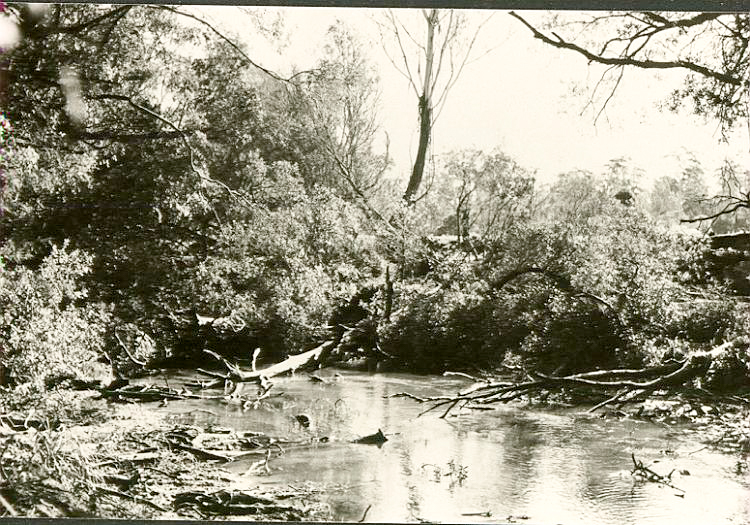
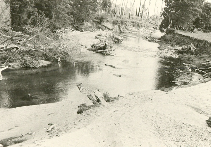
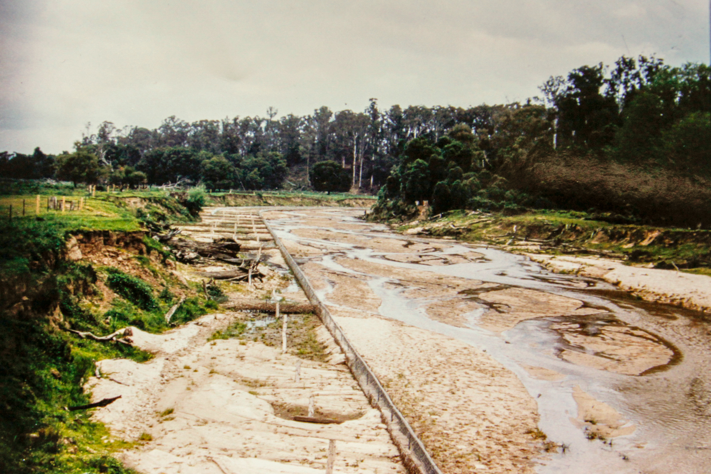
A major flood in February 1919 commenced a process of bank erosion, channel widening and the stripping of topsoil from the floodplain. Photographs in the 1930s, 1940s and 1950s show a massive widening of the river channel with high, eroding banks following major flood events.
Extensive works were undertaken in an attempt to manage these channel changes by private landholders, the Cann River Improvement Trust (1963-1990) and the East Gippsland River Management Board (1990-1997). These works included desnagging, the clearing of vegetation and channel straightening.
Unfortunately, these works increased flow velocity and stream power which significantly reduced the capacity of the channel to withstand erosion.
Following the 1978 floods, the Cann River Improvement Trust embraced the view of the Trust engineer Ian Drummond to hold the alignment of the river through retard fields and bank protection works, and to stabilise the channel with bank vegetation. Other works included eradication of willows and wattles growing in the channel, erection of stock exclusion fencing, and revegetation using native species.
After 1990, these works were continued by the East Gippsland River Management Board.
A 1997 report also identified bed degradation in the floodplain reach since 1983 as a major contributing factor to the instability of the river. The report considered that without bed stability, the banks were prone to erosion due to loss of support at the ‘toe’ of the bank and an increase in bank height. And without bank stability, the conditions would not be right for indigenous vegetation to become re-established and provide natural defences against further erosion.
The report also recommended the construction of rock structures to stabilise the river bed.
The June 1998 flood on the Cann River upstream of the floodplain reach was estimated to be a 30 to 40 year ARI event. The flood caused an estimated one metre drop in the river bed, increased channel capacity, and threatened the integrity of public and private infrastructure including the Princes Highway Bridge, the Telstra optical fibre cable, the West Cann Bridge, river rehabilitation works and private property.
The Flood Response Program (FRP) consisted of three components – grade control structures, intermediate structures and revegetation.
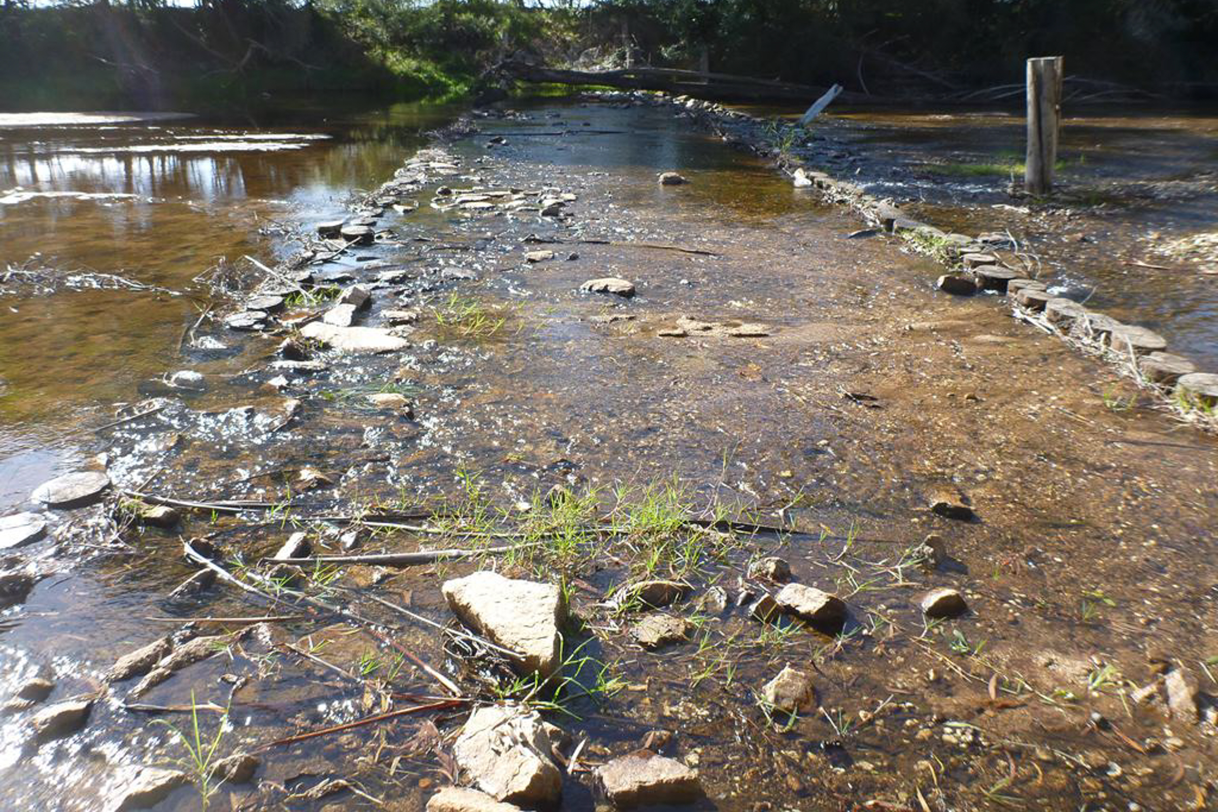
The FRP proposed that seven grade control structures (rock chutes) be built to increase the stability of the bed and banks, and reduce the risk of ongoing stream bed deepening. In the end, four grade control structures were built above the Princes Highway Bridge.
‘Intermediate structures’ (pile fields) between the grade control structures were also proposed to reduce the potential for the fluidisation of the stream bed and assist with the re-establishment of vegetation. Twenty structures were proposed. In the end, nine structures were built (8 above the Princes Highway Bridge).
Revegetation was designed to support and complement the immediate and long term stabilisation of the rock structures. Extensive plantings of native vegetation, including sedges and rushes in the sand bed of the river, were completed in 1999 and following years.
These works have been continued in recent years by the East Gippsland CMA. These works have included the maintenance of fencing to prevent stock access to the river, weed control including willows, revegetation, rock chutes and pile fields. Additional pile fields were constructed below the Princes Highway Bridge in late 2012.
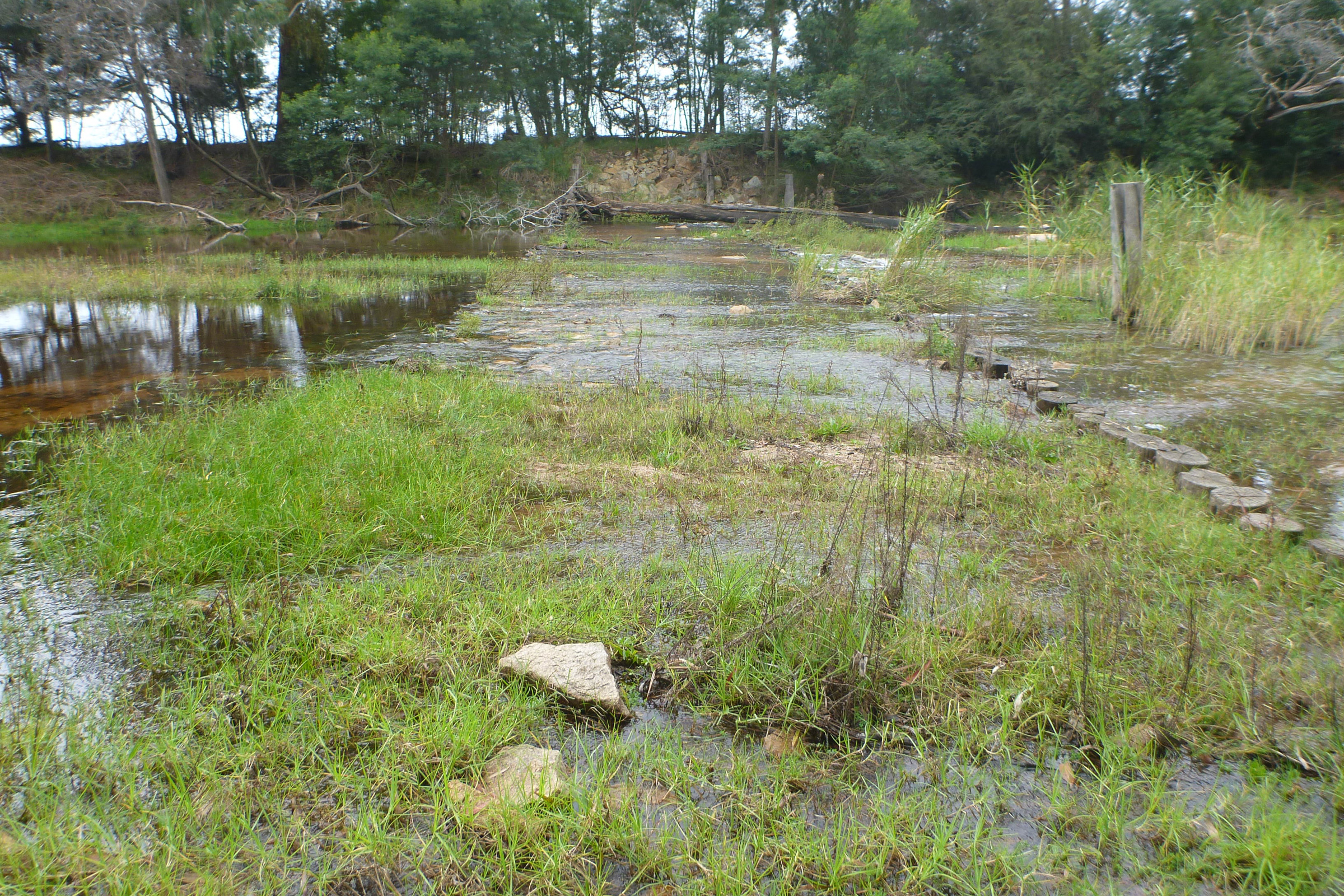
These works are designed to support a ‘natural healing approach’ to the rehabilitation of the river which is expected to take some years to occur. As the vegetation becomes established it will provide natural defences against erosion, although some damage is expected to occur during major flood events.
Over time, the river channel will reduce in size. During major floods, the river is expected to ‘break its banks’ and flow onto the floodplain, releasing the destructive force of the water that was previously retained within the river channel and caused so much damage in the past.
Gallery