The Lake Tyers estuary extends from the sand barrier on the Ninety Mile Beach to Nowa Nowa. The entrance is subject to strong currents and wave action, and sand supply along the beach has frequently closed the entrance.
Lake Tyers Estuary Opening fact sheet can be found here.
Stratification and low dissolved oxygen
Stratification of water in an estuary can occur in certain conditions and is the separation of saltwater from freshwater. This is because the higher salt content of saltwater which makes it denser than freshwater. The difference in density means that when saltwater enters estuaries it flows in along the bottom and wedges underneath the freshwater. Stratification of the fresh and saltwater in an estuary often occurs during periods of low flow, particularly during summer and early autumn when there is little mixing between the two layers due to decreased freshwater inflows and a closed estuary mouth.
Closure of an estuary and little in or outflow can also result in deoxygenated water, particularly towards the bottom of the water column. Deoxygenated water is when more oxygen is being used up than can be replaced. Decomposition of organic matter uses oxygen in the water and increases when additional areas of vegetation are flooded, for extended periods (leaves and debris breaking down). When there is no oxygen present then decomposition becomes anaerobic, which means that it is done without oxygen.
This leads to the production of hydrogen sulphide, which is commonly known as rotten egg gas due to its smell. Oxygen can be replaced in water through photosynthesis of aquatic plants (plants growing); direct diffusion from the atmosphere (rain); turbulent aeration (wind / waves) and through tidal and freshwater inflows.
Pattern of closures
Between 1987 and 2023 the estuary was closed for 78% of the time and on average was open 82 days of a year. The Lake Tyers Estuary is subject to long closures due to its small catchment size relative to its surface area. Westerly waves and winds play a large role in driving sediment transport and building the sand barrier in front of Lake Tyers Estuary, disconnecting the estuary from Bass Strait.
Location of flooding
Inundation occurs at boat ramps, jetties, camping areas and fishing platforms at Nowa Nowa during periods of extended closure. There may also be restricted access to boat ramps and walking tracks at Lake Tyers.
Level required for a successful opening
The water level in the estuary during an extended closure is about 1.7m (indicated by marks on infrastructure surrounding the estuary). The maximum water height, where the entrance either opens naturally or is opened manually, is approximately 2.3m (as indicated on the gauge at the boat ramp). This significant variation underlies that fact that the opening is associated with periods of high intensity rainfall and the corresponding inflows.
Responsibility for an opening
A natural opening is the preferred outcome. However, if an artificial opening is to be made, this is authorised by East Gippsland CMA and operationalised by Parks Victoria.
Estuary monitoring
Water height levels are found on Victoria’s Water Measurement Information System | WMIS Site (WMIS). These measurements are taken from a gauge located at Lake Tyers boat ramp at Lakeside Drive.
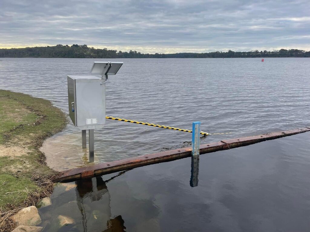
Remote solar-powered cameras have been installed. These cameras collect images every day of the estuary mouth conditions. The images provide the ability to record and track changes in estuary mouth conditions which can be further analysed in conjunction with historical records, to understand long term trends.
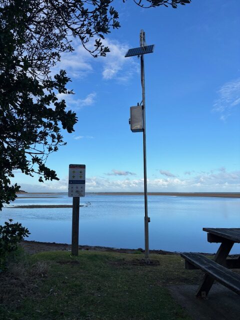
Lake Tyers – remote solar-powered camera
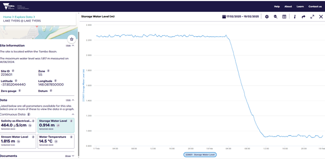
The page from WMIS above shows the maximum height prior to opening on 18 February 2025 and then the decline in the water height following this.
Once open the estuary water level drops to close to sea level within 24 to 36 hours and creates a significant entrance through the sand-bar. The duration of the opening varies and depends on the inflows and prevalence of strong westerly winds.