Sydenham Inlet is a large open shallow body of water with a short, narrow channel to the ocean. Once closed, the estuary rarely opens naturally.
Sydenham Inlet Estuary Opening fact sheet can be found here.
Pattern of closure
During the data period between 1987 and 2023 the Inlet has closed on 47 occasions. Closures of Sydenham Inlet occur more frequently during periods of reduced catchment runoff.
Location of flooding
Flooding occurs on roads, wharves and boat ramps.
Level required for a successful opening
The entrance opening level has been set historically at a point where inundation of farmland protected by levees is reached. This level is 1.65m. These levels can be determined by viewing the gauge at the boat ramp.
Responsibility for an opening
Parks Victoria coordinates the works component of the opening which is approved by East Gippsland CMA.
Estuary monitoring
Water height levels are found on Victoria’s Water Measurement Information System (WMIS). These measurements are taken from a gauge at Sydenham Inlet.

Remote solar-powered cameras have been installed. These cameras collect images every day of the estuary mouth conditions. The images provide the ability to record and track changes in estuary mouth conditions which can be further analysed in conjunction with historical records, to understand long term trends.
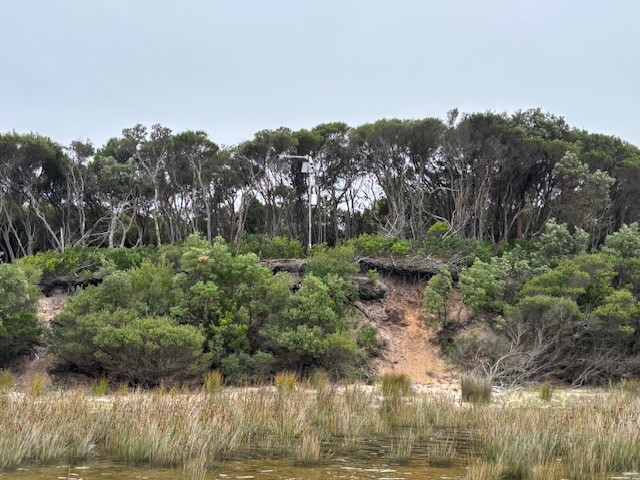
Sydenham Inlet remote solar-powered camera